Citations cartographiées
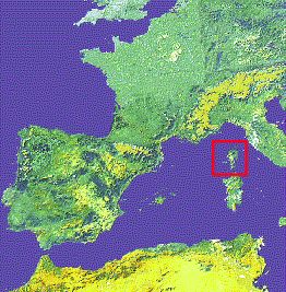
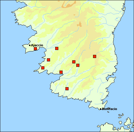
- FR-Corse
| 2A-Ajaccio |
| 'Punta de la Parata (W of Ajaccio)' (Taiti & Ferrara 1996) |
| 8.70440x41.92832 |
Centroïde commune |
| 2A-Cauro |
| 'Between Cauro and col de St-Georges (E of Ajaccio)', 650-680 m (Taiti & Ferrara 1996) |
| 8.89232x41.90550 |
Centroïde commune |
| 2A-Coti-Chiavari |
| 'Punta di u Carapono (Coti-Chiavari)' (Taiti & Ferrara 1996) |
| 8.74540x41.76874 |
Centroïde commune |
| 2A-Moca-Croce |
| 'Forêt de Valle Mala (SE of col de St-Eustache)' (Taiti & Ferrara 1996) |
| 9.02354x41.77791 |
Centroïde commune |
| 2A-Olmeto |
| 'Valley below chapelle Pianelli, between Casalabriva and Olmeto' (Taiti & Ferrara 1996) |
| 8.89753x41.71521 |
Centroïde commune |
| 2A-Pietrosella |
| 'Between Pietrosella and Fogolina (SE of Porticcio)' (Taiti & Ferrara 1996) |
| 8.80459x41.82586 |
Centroïde commune |
| 2A-Quenza |
| 'Col de Bavella' (Taiti & Ferrara 1996) |
| 9.21379x41.79441 |
Centroïde commune |
| 2A-Quenza |
| 'Between Alza and Argiavara (col de Bavella), along the first left tributary stream of S. Pietro river' (Taiti
& Ferrara 1996)
|
| 9.21379x41.79441 |
Centroïde commune |
| 2A-Sartène |
| 'Tizzano and surroundings (SW of Sartène)', 700 m (Taiti & Ferrara 1996) |
| 8.92836x41.57780 |
Centroïde commune |
| 2A-Sartène |
| 'Monte Rosso (SE of Sartène)', 700 m (Taiti & Ferrara 1996) |
| 8.92836x41.57780 |
Centroïde commune |
| 2A-Zerubia |
| 'Between col de St Eustache and col de Tana (W of Aullène)' (Taiti & Ferrara 1996) |
| 9.05431x41.74668 |
Centroïde commune |
Citations non-cartographiées
- FR-Corse
| ? |
| 'Fiumicicoli river valley', 700 m (Taiti & Ferrara 1996) |